Brief characteristics of the region
Western Kokshaal-Too is the most southern mountain range in Kyrgyzstan. This range is situated in the Central Tien-Shan between Lake Issik-Kul and desert Takla-Makan, on the boundary between Kyrgyzstan and China. Range Kokshaal-Too borders on the rivers Uzengu-kuush in the north and with the river Kokshaal in the south.
|
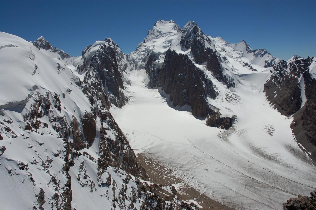
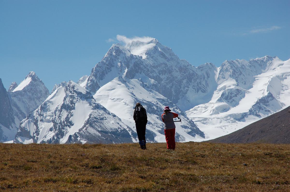
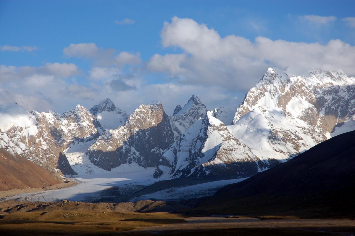
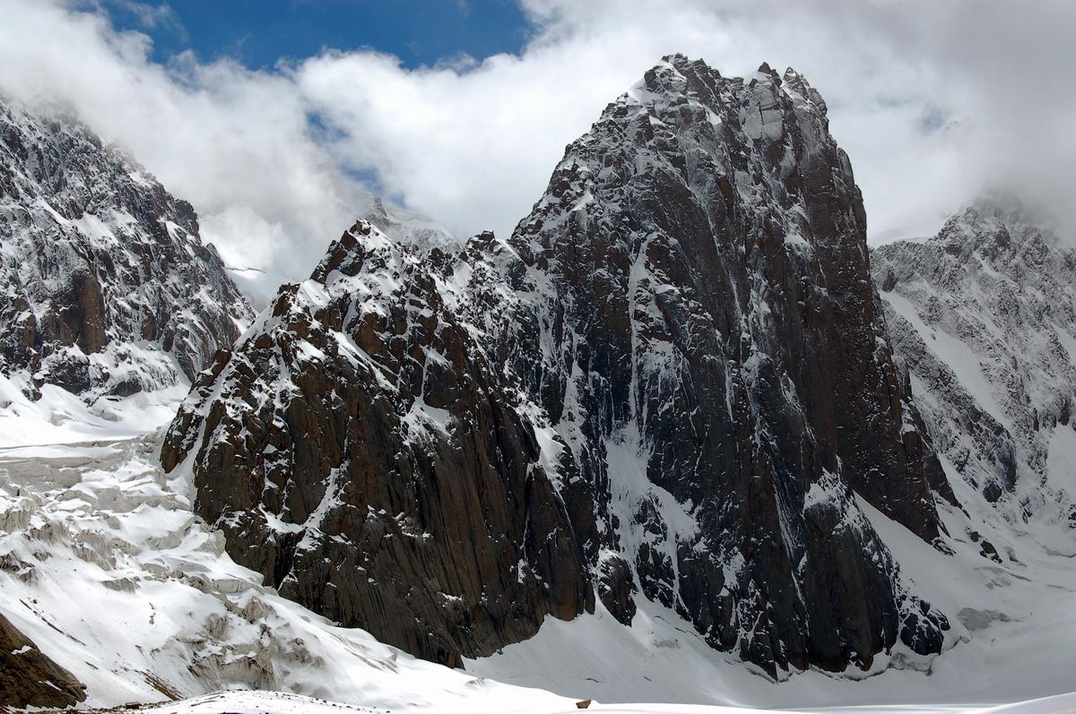
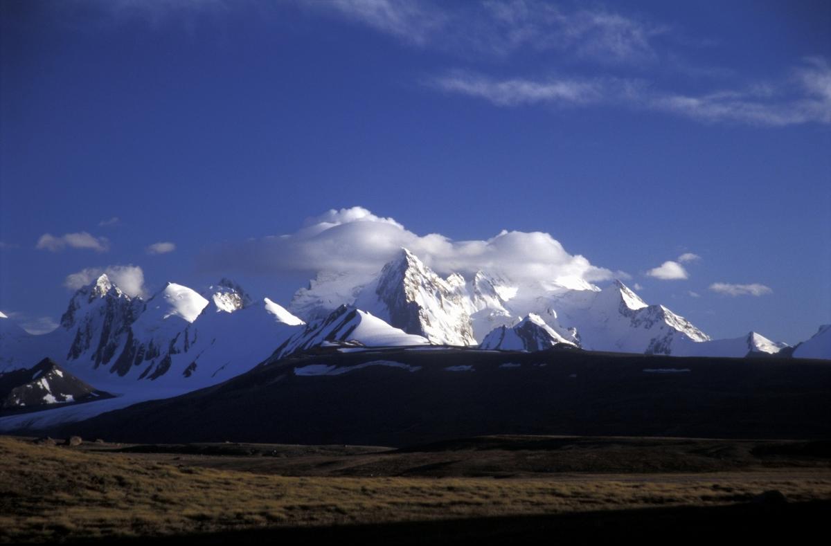
In this region there are situated any summits of about 6000 meters high. The most interesting among them are Peaks Kizil-Asker ( 5842 m), Krilia Sovetov (Wings of Soviets) ( 5800 m), Peak of Shmidt ( 5954 m, has not been conquered yet), Peak Dankova ( 5982 m)m Peak Chon-Turasu or Dzholdash ( 5729 m), Peak Alpinist ( 5641 m), Peak of Sergey Korolev ( 5816 m). Combination of typical alpine forms (there are many vertical rocky walls with elevation changes of about 1.5- 2 km) with giant glaciation, yielding to the glaciation only in the region of the Peak Pobeda in the Tien-Shan, is typical for this region. All the region, including lowlands, is zone of permafrost. Water-logged grounds are often up to altitude 4000 m.
Snow line is located on the altitude of about 4000- 4500 meters above sea-level. Valleys of rivers have altitudes 3000- 3500 meters above sea-level. Climate in the valley is inclement. Average monthly temperature equals about 5-8 degrees above zero in summer, weather is changeable.
History of settling
For ten years I was dreaming about trip to mountains of the range Kokshaal-Too. For our expedition (that took place in August 2007) we chose the region of the Peak Kizil-Asker. I was impressed by the beauty of peaks on the photos of Alexander Ruchkin. On tourist scheme of the region, that we found in the Internet, there was the name if only one summit in the region, to be more exact, it was the Peak Kizil-Asker. All other summits were marked uncertainly, and, it seemed, roughly. We also learnt from the Internet that in the 80-s of the last century in the region of the Peak Kizil-Asker expeditions from Kazakhstan leaded by J. Popenko (team SAVO, 1980), K. Valiev (1985), Iliinsky and Sidelnikov (1989) worked. The team of K. Valiev passed a route to the peak Kizil-Asker 5842 m along the north-western wall. Moreover, in the region of the peak Kizil-Asker several foreign expeditions worked. But we didn&rsquot manage to find more detailed information about those expeditions.
Having learnt on the eve of the year 2007 that the team of Alexander Ruchkin &ldquo Russian Way &ndash World Walls&rdquo was going to the Kizil-Asker, I got in touch with Alexander Ruchkin and Mikhail Mikhailov. But their answer was not comforting. They had some photos of the summits in that region and that was all. There is enough information about the region of the Peak Dankova. It is stated on high-level and with many details on the web-site www.alpclub.ru of alpinists from town Chernogolovka near Moscow. We also used information published in tourist report (leader Novik): http://www.mountain.ru/mkk/biblio/tian-shan/chetiani/vvedtnie.shtml. During our expedition we got their note from the pass &ldquoSolo on Underwood&rdquo.
As we hadn&rsquot found map of the region with named summits, in order to understand each other during the expedition we gave names to some of summits. Some names are relative, as we have not been on all the summits. The members of the expedition made ascents to peaks along easy routes mostly. It seems to me that the region of the Peak Kizil-Asker has been almost blank spot on the alpinistic map and it harbors lots of interesting routes that have never been passed before. The only thing is that there are no very extensive walls with elevation changes of more than 100 meters (from the side of Kyrgyzstan, from the Chinese side there are some, according to material of the expedition of Alexander Odintsov), but, taking into account not very difficult approach &ndash this region can become an interesting alternative for those alpinists who are full of the spirit of adventures and exploring and for those who have not already found enough money to make ascent along unpassed Himalayan, Karakorum, Kunlun walls. And the beauty of Tien-Shan can subdue every not indifferent to the mountains man.
Approaches
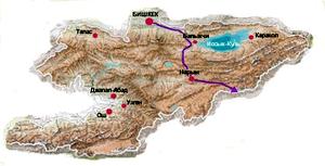
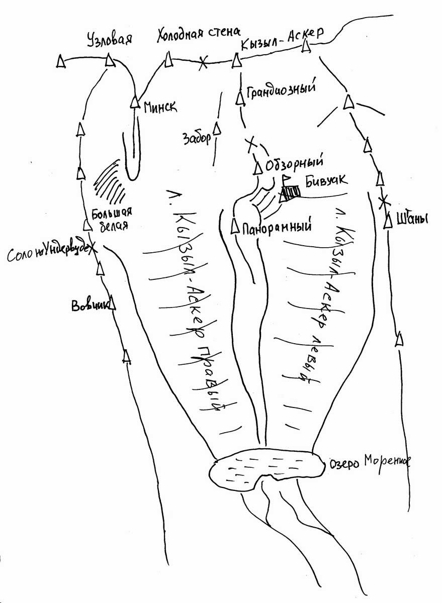
 Map of the region of the Kizil-Asker |
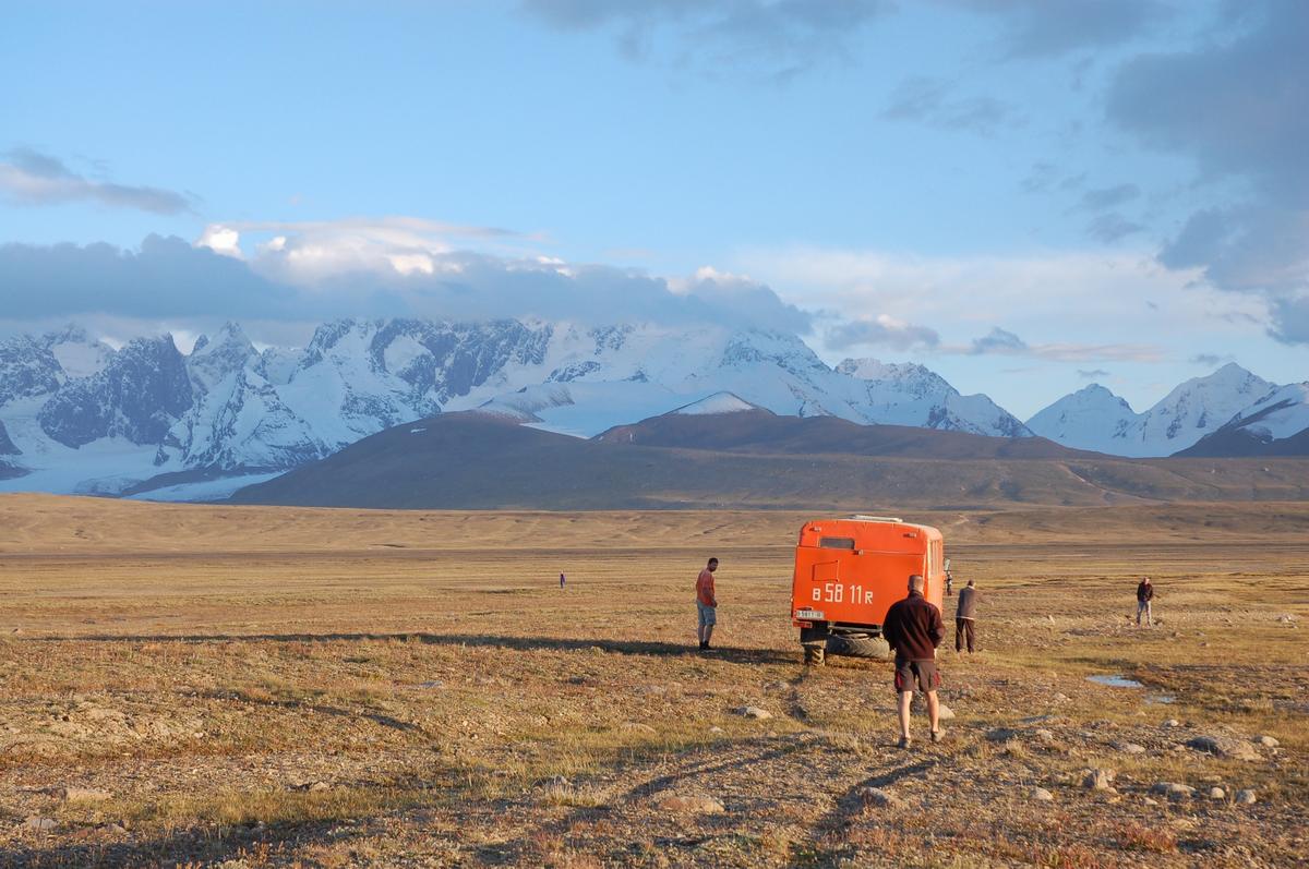
The second way of getting to the region, by car, we have chosen. Road to the region is itself worthy of independent deion. It takes two days, with passing a night in town Narin. The road consists of continuous changing of landscapes through three passes and at the end there is road (if it is possible to name this strip so) along the Aksayskaya valley. After settlement Orto-Kashka-Suu (one dwelling house), at the same place frontier post is situated (the region is frontier zone and it is necessary to order permits beforehand), there is way along destroying road along the remains of wire entanglement, remains of telegraph poles and hardly noticeable CTS (control-track stripe) &ndash these are the remains of once great country, Soviet Union.
 Range Borkoldoi and plateau Kagaliachap |
Somewhere upper the remains pf the frontier post on the map OTF are marked, we turned from the road and started crossing the plateau from the north to the south, in the direction of the lake Bivachnoe. We crossed it, having sent scouts forward, they literary drawn ground. Twisting, often riding along the beds of numerous rivers, wasting several hours for that, our car successfully crossed the plateau but managed to get stick on rising ground. We had to get everything from it and to put it back. Our Base Camp we made near small stream, in about an hour of walking from the lake Bivachnoe on the altitude about 3750 meters. It is also possible in my opinion to get to the lake Bivachnoe by car, but it is necessary to ride along the braches of the river flowing out from the glacier Kizil-Asker. It is necessary to turn from the road somewhere opposite to the big stone �� on the map. But there always is risk of getting stick in the bog. Approach with the help of two cars is counted to be more reliable: the first car pulls tow-line and the second one is always ready to come to the rescue, but again finance question stand appears.
|
|
Mikhail Mikhailov (Bishkek) told us about the variant of approach to the valley of the glacier of Komarov (source of the river Kizil-Unet) beyond the edge separating glaciers of Komarov and Kizil-Asker. That variant is more reliable concerning passage, but in this case approach to the glacier right Kizil-Asker and especially to the glacier left Kizil-Asker can become noticeably harder and longer.
The region of the Peak Kizil-Asker is geographically far from every dwelling. The nearest dwelling (not counting Chinese settlements) &ndash is the post Orto-Kashka-Suu. (It took us 3 hours to get back to it from the Base camp, as we knew road). There are no herders for many tens of kilometers. From alive creatures there are only animals and birds. Marmots are everywhere, ram Marko Polo can be come across (it doesn&rsquot let you get closer to itself), wolfs howl at nights, and in the sky eagles or griffon-vultures go round (it seems to me that eagle do not get into flocks).
Weather
It is counted that optimal time for holding expedition here is the second half of August and the first half of September. As it has been already mentioned, weather is extremely unstable here. During one day it is sometimes possible to come across several seasons: winter, summer, autumn, spring. Moreover there is no any regularity. Rain or wet snow can start in the morning or in the afternoon, or closer to evening. But there also are possible several days of fine weather one after another. The main thing is that when we were in the region there were no long periods of bad weather, maximum &ndash 14 hours (more often &ndash from 2 to 6 hours)
 Base Camp |
Place of our base camp was opened to all the winds. Tent &ldquo Angara&rdquo of the firm &ldquoRock Pillars&rdquo gave a good account of itself.
Quick change of weather makes for really unearthly views, that I have seen before anywhere in the mountains, nor in summer, neither in winter. During our standing in the mountains I drew a conclusion that at that time, it means, in August, the weather can not cardinally influence on the ascents, taking into account character of the routes. It becomes rather cold even when the weather is generally fine when wind from the plateau Kagaliachap begins to blow. Taking into account all these facts, it is necessary to have corresponding clothes and corresponding mood.
Routes
 Schemes of routes |
 Schemes of routes |
On the northern sides of summits cracks are often filled with wandering ice. Near to the point 5000 meters above sea level ice looks like winter. Cam devices, stoppers, various hooks and ice screws are often used for organizing belay.
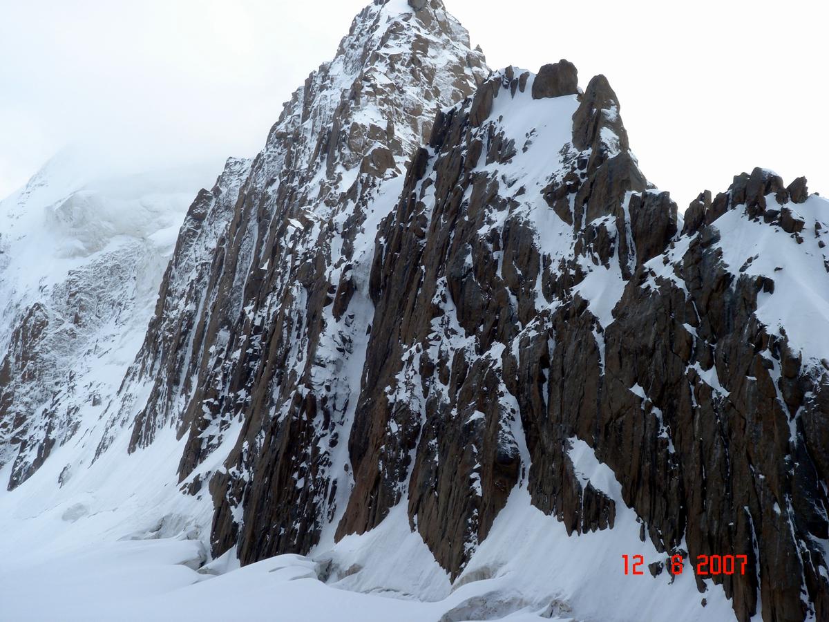
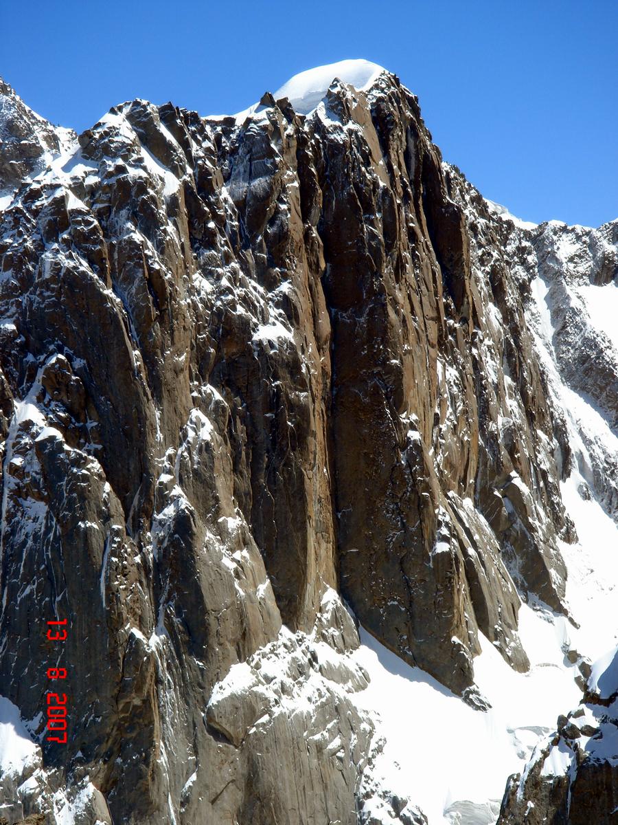
From the point of view of alpinist I would like to divide the region conditionally into two parts: the region of the glacier Left Kizil-Asker and the region of the glacier Right Kizil-Asker (orographically). From the glacier Left Kizil-Asker ascents to the Peak Kizil-Asker (northern and north-western walls) and Peak Grandiozny are mostly made. Ascents to other summits can have exploring and training character. It seems to me that there is one route to Kizil-Asker, the route of Valiev (1985) along north-western wall. The northern wall of the Peak Grandiozny, in my opinion, has not been passed yet. I have no information about successful ascent along it, at least.
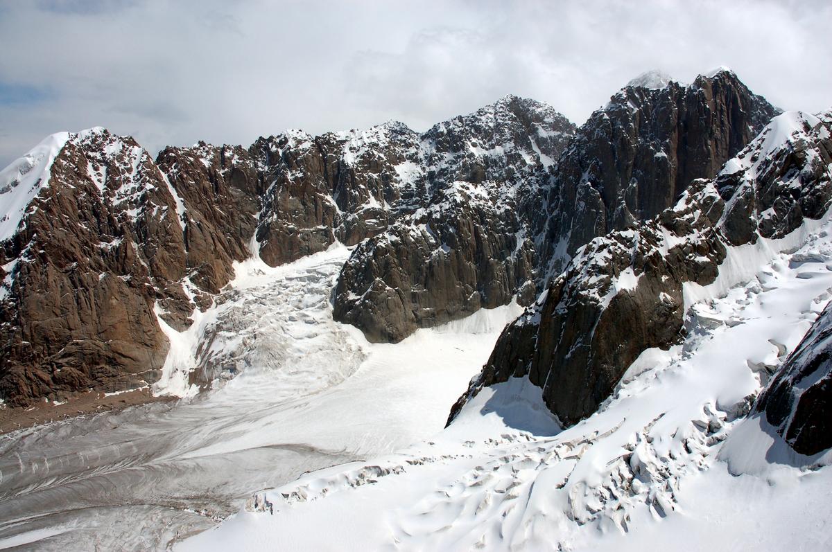
 Above the glacier Right Kizil-Asker |
 Peak Minsk(5045 m) |
 Bulwark Zabor and Peak Grandiozny ( 5432 m) |
Opposite the bulwark &ldquoZabor&rdquo there is the summit conditionally named &ldquoBig White&rdquo (because of a giant snow-ice cap on the top of the mountain) with very long south-western wall built of large monolithic blocks and having a lot of variants of ascents to it. In addition to the summits named above, it is also possible to make interesting ascents to following mountains: Cold wall, Uzlovaya and other. There the easiest way &ndash descent route of the team of Valiev to the Peak Kizil-Asker also starts.
 From the valley of the glacier of Komarov |
Useful information
Organization of the base camp . There are no useful improvised materials in the place where it is possible to organize the base camp. It is understandable as the region is rarely visited. So, in order to make comparatively comfortable life conditions, it is necessary to bring everything you need with you.
Approaches to the summits of the region even from the place of our base camp are not so long and take about 5-7 hours up to the beginning of routes, depending on the summit you have chosen. In comparison with other mountains approaches to the summits are unusual. In the beginning it is necessary to walk literary along the steppe, or, if you like, along the tundra, rounding waterlogged strips. Direction of walking &ndash from the base camp to the left-side (along the strike) moraine of the glacier Right Kizil-Asker (orographically). There are marks placed by our team. There is one more way, requiring fewer efforts, along the glacier, but it requires some orientating skills. Way from the side moraine to the glacier is also marked with signs.
Routes that have been passed. Peak Minsk along the Eastern edge, approximately 5A grade of difficulty. Bivouac on the moraine of the right glacier Kizil-Asker under the Peak Big White. The route is very long and hard. Monolithic rocky outcrops of the edge provide the main difficulties, rounding them often requires lots of forces and time, and demands attention and belay. Climb to the apical tower is simpler, but it is more difficult if technical sense. Descent from the summit: along the edge to the bottom of apical tower and 150 meters down (steep descent using special devices) to the bottom of south-eastern wall of the Peak Minsk.
 Descent from the Peak Minsk to South-East. |
Peak Obzorny along the western slope and northern edge, approximately 3B-4A. Bivouac on the moraine of the left glacier Kizil-Asker under the ice slope. Ice slope 400 meters long with obligatory belay leads to the plateau under the Peak Panoramny, then along the rocky edge covered with snow the is coming out to trough under the top and then along snow edge up to the top. Descent should be made along the way of ascent to the plateau and further by couloir, rounding the glacier to the bivouac.
Peak Shtani along the eastern slope, approximately 1B grade of difficulty. Setting off from the bivouac on the moraine of the left glacier Kizil-Asker under the Peak Panoramny. It is necessary to cross the glacier in the direction of the Peak Shtani and climb up to the top along snow-ice slope, there can be some cracks. Descent should be made along the way of ascent.
 The team, Odintsov and doctor Bakin |
|
|
|